Do you prefer using electronics or the tried and true methods of a map and compass?

All photo credits: Josh Kirchner


All photo credits: Josh Kirchner
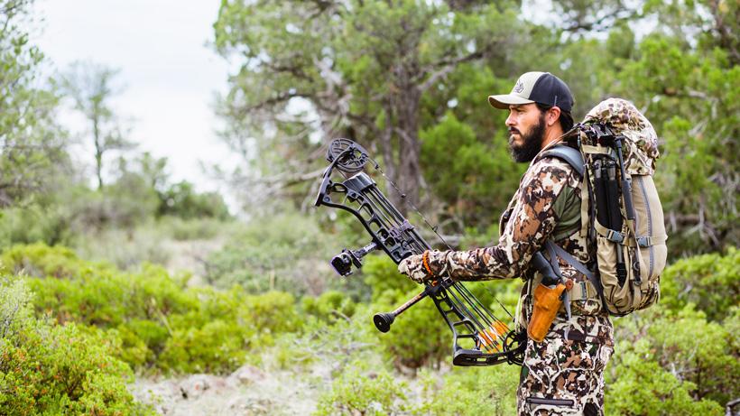
Each year that goes by, I find myself trying to figure out ways to get farther and farther from the truck come hunting season. This is both strategic and therapeutic, really. Strategic because getting farther from the truck, roads and trails flat out means fewer hunters. That’s something that has remained a constant and I think it always will. It’s therapeutic, though, because it pushes my mental threshold. Leaving the truck and living in the dirt comes with its own mental hurdles. As a kid, I remember my dad not wanting to venture too far from our rig. While we never got lost, it was something that he always made me aware of. This is one of those mental hurdles and having a solid grasp on different navigation techniques, I think will only leave you feeling more confident when you do leave the vehicle in the dust. Having a map and compass was something that I was taught to do from a young age. Today, though, we live in a different world. More and more folks are solely bringing their phones or GPS into the hills with them. I don’t think this is necessarily wrong, but it does arise the question of which one is better. Traditional land navigation or our new electronics of today?
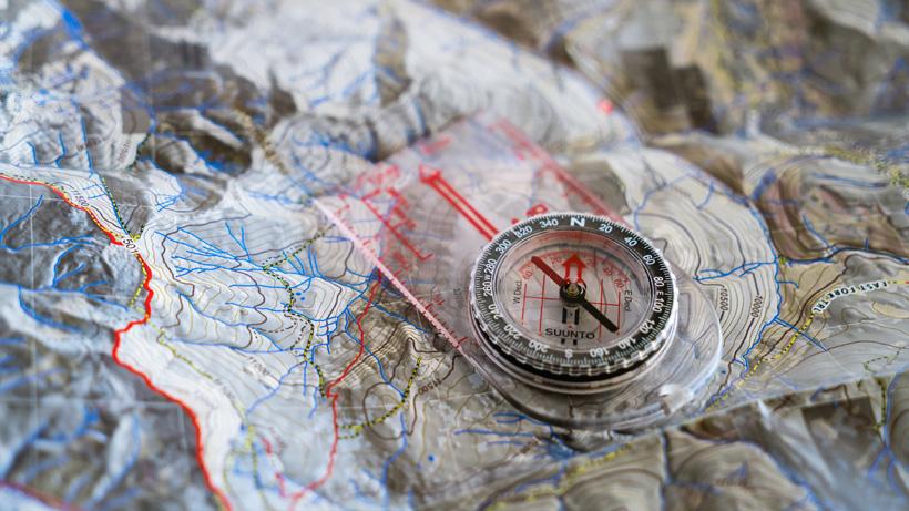
Let’s start at the beginning here. Before we had the luxury of fancy electronic devices, there was a map and a compass. These tools of the trade could guide us through the country and give us the lay of the land. The big picture. This is what I always have appreciated about looking at an actual map. There is no scrolling around on a screen. Everything is right there in front of you, begging to be seen. This is my preferred method for doing “homework” before a hunt. I can get a solid understanding of the country and how it’s laid out. This helps when it comes time to actually step foot in it. Having country memorized, though, is not the sole way that you should go about utilizing a map and compass.
Before heading out into the field with nothing more than a map and compass, you should really take the time to learn some basic land navigation techniques with these tools. There is a little bit more than just knowing which direction is north. While I’m not going to layout an in-depth how-to for this section, I will give you some things to look up. Learn how to read a topographic map, how to figure out where you are on said map (this is vital) and then how to apply your compass to that map in order to plot a direction of travel. Also, make sure that you set your compass to the right declination. This is going to be the difference between true north and magnetic north. Your compass will not give an accurate reading unless you do this. Using these traditional methods of navigation definitely takes a little time in the moment, but they are solid and won’t run out of battery life.
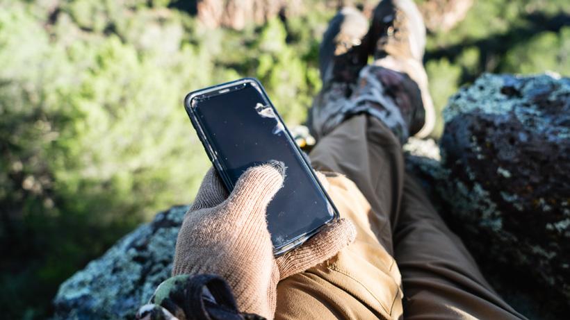
If I had to guess, I’d say that the better part of our community is utilizing the aid of electronics for navigation. I don’t blame them as I do the same for the most part. If someone isn’t using some sort of mapping app or just a regular GPS, they are really missing out. Efficiency is the word that comes to mind here. The convenience of doing so is second to none and it’s now easier than ever to keep track of certain areas of interest and figure out where you are. Owning a GPS for the first time changed my confidence level in the field. It put me at ease and I even had to truly use it a time or two after getting lost. “Thank goodness for the Garmin GPS!” I remember saying to myself. Before leaving the truck, I always mark a waypoint right there. No matter where I am, knowing the location of my vehicle is what will guide me back to it should I need help. I will also always mark my camp when backcountry hunting as well as where I shoot from and where I find first blood after a shot. This all paints a picture and it’s one that is greatly appreciated.
Of course, electronics are not fail-proof. Whether we are talking about batteries dying or malfunctions, they happen. This is something that needs to be taken into consideration. The battery thing is quite avoidable with proper planning and responsible practices. Making sure the battery is at full charge before a trip, turning the device off when not in use and, then, bringing along a power bank are all things that can help here. Now, the malfunctioning aspect? Well, that is something that I wouldn’t say is an everyday occurrence, but it can and does happen. Recently, a mapping app told me I was four miles east of where I actually was. Luckily, I knew the area intimately and was paying attention from the get-go. After restarting the app, my actual location popped up, not the invalid one. That could have been bad had I put my full trust in it.
Now, we are still left with that question from the beginning. Which is better? Land navigation via map and compass or electronics? My answer is to dip your toes in all of it. They are all valid and valuable tools in a hunter’s toolbox. Using electronics is really going to aid in efficiency. Yes, batteries can die and malfunctions—while not super common—can happen. For that reason, having the skills and know-how with a map and compass needs to be there as well. If I have my choice, I’m going to choose electronics because of the efficiency that comes with it. After using it for quite a while, not utilizing it seems kind of silly to me in this day and age. Logging a ton of data with a few swipes on a screen is much appreciated. However, I really enjoy having a true paper map in my pack with a compass. Should the batteries die or my device go crazy on me, this is there to continue my journey and get me home safe.
Where do you fall in this? Do you prefer using electronics or the tried and true methods of a map and compass?